LIRIS - GEOMOD à SIGGRAPH 2013
In collaboration with researchers at the university of Purdue (USA),
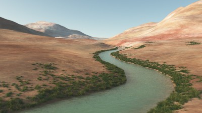
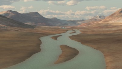
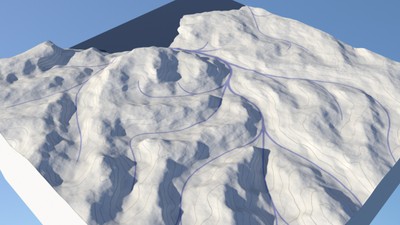
The GEOMOD team of the LIRIS UMR 5205 CNRS has developed a framework that allows quick and intuitive modeling of terrains using concepts inspired by hydrology.
The originality of this approach is to create a hydrologically consistent terrain model whose elevation data is derived from the procedurally defined river network.